Understanding Flood Risk Activity Permits: When Standard Rules Apply
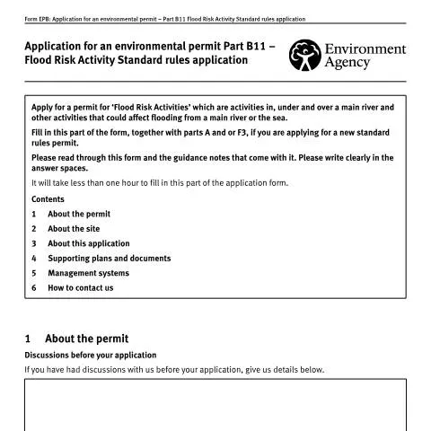
When developers, contractors, or landowners plan activities near England's main rivers, they often discover that even seemingly minor works can trigger complex environmental permitting requirements. The Environment Agency's Part B11 standard rules application represents a streamlined pathway for obtaining flood risk activity permits, designed to accelerate approvals for common interventions whilst maintaining rigorous environmental protection standards.
This application route specifically targets activities that occur in, under, or over main rivers and other works that could influence flooding patterns from main rivers or coastal waters. Unlike bespoke permit applications that require extensive technical assessments, standard rules permits operate within predefined parameters that have already undergone comprehensive environmental evaluation by the Environment Agency and Defra.
The Part B11 form functions as a critical component within the broader Environmental Permitting Regulations framework, serving applicants who can demonstrate their proposed activities align precisely with one of fifteen established standard rule sets. These range from temporary dewatering operations affecting up to 20 metres of river channel to installing clear span bridges with specific dimensional constraints.
Decoding the Fifteen Standard Rule Categories
The Environment Agency has developed fifteen distinct standard rule sets under the 2015 and 2019 series, each addressing frequently encountered flood risk activities. Understanding which category applies to your specific proposal determines not only the application pathway but also the subsequent operational conditions and monitoring requirements.
| Standard Rule Set | Activity Description | Key Limitations |
|---|---|---|
| SR2015 No.26 | Temporary dewatering | Maximum 20 metres of river affected |
| SR2015 No.27 | Outfall installation | 300-500mm diameter through headwall |
| SR2015 No.28 | Clear span bridge | Up to 8 metres span, 4.2 metres width |
| SR2015 No.29 | Temporary floodplain storage | Within main river floodplain |
| SR2015 No.30 | Temporary river diversion | Temporary duration only |
Temporary activities feature prominently within the standard rules framework, reflecting the Agency's recognition that short-duration interventions often present manageable environmental risks when properly controlled. SR2015 No.34, covering temporary scaffolding, exemplifies this approach by permitting structures affecting up to 20 metres of main river length whilst requiring specific installation and removal protocols.
More permanent interventions, such as channel habitat structures using natural materials (SR2015 No.31), accommodate ecological enhancement projects whilst limiting scope to 100 metres of river length. This constraint ensures individual projects remain within acceptable impact thresholds whilst enabling cumulative habitat improvement programmes across catchments.
Recent Additions and Evolving Practices
The SR2019 series introduced three additional categories addressing emerging infrastructure needs. Water gates across main rivers (SR2019 No.3) reflect increased flood management sophistication, whilst mooring pile installations (SR2019 No.1) acknowledge growing recreational waterway usage demands.
SR2019 No.2 covers steps, ramps, and similar structures excavated into existing bank profiles, addressing accessibility requirements whilst maintaining river corridor integrity. These additions demonstrate the Environment Agency's adaptive approach to emerging development pressures and changing land use patterns.
Navigating Site-Specific Requirements and Grid References
Accurate site identification forms the foundation of successful Part B11 applications, with the Environment Agency requiring Ordnance Survey National Grid References for all proposed activity locations. This precision enables automated screening against environmental constraints databases and facilitates rapid application processing.
For activities spanning watercourse stretches rather than discrete locations, applicants must provide both upstream and downstream grid references. This requirement particularly applies to works under SR2015 No.38 (gravel removal operations) and SR2015 No.31 (channel habitat structures), where linear extent directly influences environmental impact assessment.
The watercourse name identification requirement serves multiple regulatory functions beyond simple location recording. Environment Agency databases cross-reference watercourse names against existing permits, environmental designations, and flood risk management schemes, enabling rapid identification of potential conflicts or cumulative impact concerns.
Site Plan Requirements and Documentation Standards
While Part B11 includes a simple yes/no checkbox for site plan inclusion, the underlying standard rules typically mandate detailed technical drawings. These plans must demonstrate compliance with specific dimensional constraints, setback requirements, and construction methodology specifications embedded within each rule set.
Applicants frequently underestimate the technical precision required for standard rules compliance. A clear span bridge application under SR2015 No.28, for example, must demonstrate that the proposed structure maintains the specified 8-metre maximum span whilst avoiding any intermediate supports within the active channel. Site plans must clearly illustrate these constraints alongside existing infrastructure and environmental features.
Screening Reports and Environmental Compliance Verification
The screening report requirement represents a critical checkpoint within the Part B11 process, confirming that proposed activities align with standard rules parameters and local environmental constraints. While applicants can opt to submit applications without screening reports, this approach typically extends processing timeframes and introduces approval uncertainty.
Self-screening advantages include accelerated application processing and reduced rejection risks. Applicants who complete screening assessments before submission demonstrate thorough preparation and often identify potential complications before formal review commences. The Environment Agency's guidance materials provide detailed screening methodologies for each standard rule set.
Environmental constraint screening encompasses multiple assessment layers, including Special Areas of Conservation, Sites of Special Scientific Interest, flood zones, and protected species records. Activities proposed within or adjacent to designated areas may require additional assessments or fall outside standard rules scope entirely.
When Standard Rules Don't Apply
Screening processes occasionally reveal that proposed activities exceed standard rules parameters or occur within environmentally sensitive locations requiring bespoke permit applications. Common triggers include dimensional exceedances, proximity to designated sites, or cumulative impact concerns from multiple concurrent activities.
The Environment Agency maintains discretion to direct applicants toward bespoke permitting routes when standard rules cannot adequately address site-specific risks or regulatory requirements. This redirection, while potentially extending project timelines, ensures appropriate environmental protection levels and regulatory compliance.
Management Systems and Operational Compliance Frameworks
Every standard rules permit incorporates mandatory management system requirements that define operational procedures, monitoring protocols, and environmental protection measures. These systems extend beyond simple construction methodology to encompass entire project lifecycles, including planning, implementation, monitoring, and completion phases.
The Environment Agency's management system guidance establishes minimum standards for flood risk management, drainage protection, and environmental impact mitigation. Applicants must demonstrate their proposed management approaches meet these standards before permit approval, with ongoing compliance becoming a formal permit condition.
Management system components typically include:
- Detailed construction methodologies with environmental protection measures
- Monitoring and reporting protocols for environmental parameters
- Emergency response procedures for unexpected environmental impacts
- Restoration and reinstatement requirements following activity completion
- Training requirements for personnel involved in permitted activities
Compliance monitoring extends throughout permit duration, with the Environment Agency maintaining inspection powers and enforcement capabilities. Management system failures can trigger permit variations, additional conditions, or enforcement action depending on severity and environmental consequences.
Integration with Construction and Project Management
Effective management systems integrate environmental permit requirements with broader construction project management frameworks. This integration ensures environmental compliance obligations receive appropriate attention within project planning, resource allocation, and risk management processes.
Many applicants benefit from developing management systems collaboratively with construction contractors and environmental consultants, ensuring practical implementation feasibility whilst meeting regulatory requirements. Early stakeholder engagement often identifies potential compliance challenges before they impact project delivery timelines.
Processing Timeframes and Application Tracking
Standard rules applications typically process more rapidly than bespoke permits, reflecting their simplified assessment requirements and predetermined environmental parameters. However, processing duration varies considerably based on application completeness, site complexity, and seasonal workload fluctuations within Environment Agency offices.
The Agency's 03708 506 506 general enquiries line provides application status updates and processing guidance during standard office hours (8am to 6pm, Monday to Friday). Textphone services accommodate hearing-impaired applicants through dedicated 03702 422549 access.
Electronic communication channels, including the [email protected] email address, enable written correspondence for complex queries or detailed technical discussions. These channels prove particularly valuable when applications require clarification or additional information submission.
Managing Application Delays and Additional Information Requests
Environment Agency case officers may request additional information or clarification during application review, particularly when initial submissions lack technical detail or raise environmental concern questions. Prompt response to these requests significantly influences overall processing timeframes and approval prospects.
Common additional information requests include enhanced site plans, detailed construction methodologies, or specialist environmental assessments addressing specific site characteristics. Applicants who anticipate potential information requirements and prepare comprehensive initial submissions typically experience smoother processing experiences.
Multiple Standard Rules Applications and Cumulative Considerations
Projects requiring multiple standard rules permits face additional complexity layers, as the Environment Agency assesses cumulative environmental impacts alongside individual activity compliance. The guidance specifically advises checking relevant guidance notes before submitting applications for multiple different standard rules.
Cumulative impact assessment considers both spatial and temporal activity relationships. Activities occurring simultaneously within close proximity may generate combined environmental effects exceeding individual standard rules parameters, potentially requiring bespoke permit applications or enhanced management system requirements.
Sequential activity planning can sometimes address cumulative impact concerns by spreading interventions across time periods or geographical areas. This approach requires careful coordination with project delivery requirements and may influence overall construction programming.
The Environment Agency maintains discretion to require integrated assessment approaches when multiple activities occur within sensitive environmental areas or could collectively influence flood risk patterns. These requirements emerge during application screening and may necessitate alternative permitting strategies.
Cross-Reference with Other Regulatory Requirements
Flood risk activity permits operate alongside numerous other regulatory frameworks, including planning permission, marine licensing, and species protection legislation. Successful project delivery requires coordination across multiple regulatory pathways, with Part B11 applications forming one component within broader compliance strategies.
Planning authorities increasingly require evidence of environmental permit applications before granting planning permission for development projects affecting watercourses. This integration reflects growing recognition of interconnected environmental protection requirements and cumulative impact assessment needs.
Site Assessment and Flood Risk Evaluation Requirements
Before submitting your Part B11 application, you must conduct a thorough site assessment to demonstrate your understanding of local flood risks and environmental conditions. The Environment Agency requires comprehensive baseline data to evaluate whether your proposed flood risk activities will have acceptable environmental impacts.
Hydrological and Hydraulic Analysis
Your application must include detailed hydrological assessments covering both current and predicted future conditions. This involves analysing historical flood data, typically spanning at least 30 years where available, alongside climate change projections extending to 2080. The assessment should examine peak flow rates, flood durations, and return periods for events ranging from 1 in 2 years to 1 in 1000 years, depending on the nature of your proposed activities.
For activities involving temporary or permanent structures in floodplains, you'll need to provide hydraulic modelling demonstrating how your proposals will affect flood water levels both upstream and downstream. The Environment Agency typically requires 1D or 2D flood modelling using industry-standard software, with model validation against observed flood events where data exists. Your modelling must account for blockage scenarios, including debris accumulation at structures during flood events.
Environmental Baseline Studies
The Part B11 application process demands comprehensive environmental baseline assessments covering water quality, ecology, and geomorphology. Water quality monitoring should encompass chemical, biological, and physical parameters relevant to your specific location and proposed activities. This includes dissolved oxygen levels, nutrient concentrations, suspended sediment loads, and temperature regimes.
Ecological surveys must identify protected species and habitats within and adjacent to your site, with particular attention to species protected under the Wildlife and Countryside Act 1981 and habitats designated under the Conservation of Habitats and Species Regulations 2017. The timing of surveys is critical – for example, fish surveys should align with seasonal migration patterns, whilst bird surveys must cover both breeding and overwintering periods.
Geomorphological assessments should document existing channel characteristics, bank stability, sediment transport processes, and any historical channel modifications. This baseline information helps the Environment Agency assess whether your proposed activities might alter natural river processes or exacerbate erosion and sedimentation issues.
Stakeholder Consultation and Community Engagement
Effective stakeholder engagement forms a crucial component of successful Part B11 applications, often determining whether your proposals gain community support and regulatory approval. The Environment Agency expects applicants to demonstrate meaningful consultation with affected parties well before formal application submission.
Mandatory Consultation Requirements
Your consultation programme must include statutory consultees such as Natural England for sites affecting designated nature conservation areas, Historic England where heritage assets might be impacted, and the relevant local planning authority. Internal Drainage Boards require consultation for activities within their operational areas, whilst the Canal & River Trust must be engaged for works affecting their waterways.
Local flood risk management authorities, including county councils acting as Lead Local Flood Authorities under the Flood and Water Management Act 2010, should be consulted early in your planning process. These authorities maintain local flood risk management strategies and can provide valuable insights into community flood history and ongoing flood alleviation schemes that might interact with your proposals.
Parish councils and town councils often possess detailed local knowledge of historical flooding patterns and community concerns. Their support can prove invaluable during the determination process, whilst opposition based on legitimate concerns may prompt the Environment Agency to request additional information or impose stricter permit conditions.
Community Engagement Strategies
Successful community engagement extends beyond minimum statutory requirements to include proactive outreach to residents, businesses, and community groups potentially affected by your proposals. Public exhibitions, drop-in sessions, and online consultation portals can help identify local concerns early, allowing you to modify proposals or develop mitigation measures before formal application submission.
Documentation of your consultation activities should include records of all meetings, copies of consultation materials, summaries of feedback received, and explanations of how comments have influenced your proposals. The Environment Agency reviews this consultation evidence when assessing whether your activities are acceptable and whether additional permit conditions are necessary to address community concerns.
For controversial proposals, consider engaging independent facilitators to manage consultation processes and demonstrate transparency. This approach can help build trust with sceptical communities and provide neutral documentation of consultation outcomes that strengthens your application.
Monitoring, Reporting and Adaptive Management Frameworks
Part B11 permits typically include extensive monitoring and reporting requirements designed to track environmental performance and enable adaptive management responses to changing conditions. Understanding these obligations before application submission helps ensure you have adequate resources and systems in place for permit compliance.
Environmental Monitoring Programmes
Your monitoring programme must align with the specific environmental risks associated with your flood risk activities. For activities affecting water quality, this typically involves regular sampling of key parameters such as turbidity, dissolved oxygen, ammonia, and phosphorus levels both upstream and downstream of your site. Monitoring frequencies vary depending on activity type and environmental sensitivity, ranging from continuous automated monitoring for high-risk activities to monthly manual sampling for lower-risk operations.
Ecological monitoring requirements often focus on key indicator species and habitats identified during baseline surveys. Fish population monitoring might involve annual electrofishing surveys, whilst bird monitoring could require monthly counts during critical periods. Vegetation monitoring typically involves annual assessments of plant community composition and coverage, with particular attention to invasive species establishment.
Hydrological and hydraulic monitoring involves measuring water levels, flow rates, and flood extents during significant events. This data helps verify that your activities perform as predicted and enables early identification of any adverse impacts requiring corrective action. Modern telemetry systems allow real-time data collection and automated alerts when parameters exceed predetermined thresholds.
Reporting and Review Cycles
The Environment Agency typically requires annual monitoring reports summarising environmental performance against permit conditions and baseline conditions. These reports must include statistical analysis of monitoring data, trend identification, and assessment of compliance with environmental standards. Non-compliance incidents require immediate reporting, often within 24 hours for serious environmental impacts.
Permit reviews occur periodically, usually every five to ten years depending on activity type and environmental risk. These reviews assess whether permit conditions remain appropriate given changing environmental conditions, improved scientific understanding, or modifications to your activities. Proactive engagement with review processes, including submission of updated risk assessments and monitoring data analysis, helps ensure permit renewals proceed smoothly.
Adaptive management frameworks should be embedded within your operational procedures, enabling rapid responses to changing environmental conditions or unexpected impacts. This might involve trigger levels for implementing additional mitigation measures, protocols for temporary activity cessation during sensitive periods, or procedures for modifying operations based on monitoring results. Clear documentation of adaptive management decisions and their effectiveness strengthens future permit applications and demonstrates responsible environmental stewardship.