Understanding Flood Risk Activity Permits: When Development Meets Waterways
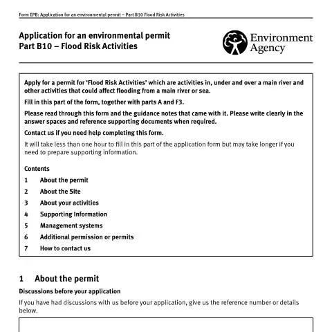
When your construction project, infrastructure development, or environmental work involves activities near, in, or affecting main rivers and coastal areas, the Application for an environmental permit: part B10 flood risk activities becomes your gateway to legal compliance. This Environment Agency form, designated EPB10, represents a critical regulatory checkpoint that determines whether your proposed activities can proceed without compromising flood defences or exacerbating flood risks to surrounding communities.
The permit system recognises that activities ranging from bridge construction and culvert installation to temporary scaffolding and maintenance work can significantly impact water flow patterns, flood storage capacity, and the structural integrity of flood defences. Unlike general planning permissions, this environmental permit specifically addresses the hydraulic and flood risk implications of your proposed work, requiring detailed technical assessment and ongoing compliance monitoring.
Form EPB10 must be submitted alongside Part A (applicant details) and Part F3 (fees), creating a comprehensive application package that the Environment Agency uses to evaluate both the immediate and long-term flood risk consequences of your activities. The assessment process can determine not only whether your project proceeds, but also the specific conditions and mitigation measures that must be implemented throughout the work.
Defining Flood Risk Activities: Scope and Regulatory Boundaries
The regulatory definition of "flood risk activities" encompasses a broader range of interventions than many applicants initially recognise. These activities include any work in, under, or over a main river, as well as activities that could affect flooding from main rivers or the sea, even if they don't directly interact with the watercourse itself.
Main rivers, designated by the Department for Environment, Food & Rural Affairs, typically include larger watercourses and those with significant flood risk implications. However, the permit requirement extends beyond the physical boundaries of these watercourses to capture activities that could influence flood behaviour through altered ground levels, changes to surface water drainage, or modifications to flood storage areas.
| Activity Category | Typical Examples | Permit Considerations |
|---|---|---|
| Permanent Structures | Bridges, culverts, outfalls, flood walls | Long-term hydraulic impact, maintenance access |
| Temporary Works | Construction scaffolding, temporary diversions | Duration limits, removal requirements |
| Ground Modifications | Excavation, embankment construction | Flood storage compensation, stability |
| Utility Installations | Pipeline crossings, cable installations | Bed and bank protection, reinstatement |
The Environment Agency's approach recognises that even seemingly minor interventions can have cumulative effects on flood risk, particularly in catchments where multiple developments are proposed or where existing flood defences are already operating near capacity. This precautionary principle means that activities which might appear insignificant in isolation require careful assessment within the broader flood risk management context.
Distinguishing Permitted Development from Regulated Activities
Not all work near watercourses requires an environmental permit. The Environment Agency maintains specific exemptions and permitted development categories that allow certain low-risk activities to proceed without formal application. However, these exemptions typically apply to minor maintenance work, emergency repairs, or activities that demonstrably reduce flood risk.
The key distinction lies in whether your proposed activity could increase flood risk elsewhere or impede the Environment Agency's flood risk management responsibilities. Activities that might qualify for exemption include routine vegetation management, minor repairs to existing structures, or emergency work necessary to prevent imminent flooding.
Technical Requirements: Flood and Environmental Risk Assessment
The cornerstone of any flood risk activity application is the Flood and Environmental Risk Assessment, which must demonstrate comprehensive understanding of potential impacts and proposed mitigation measures. This assessment goes beyond simple hydraulic calculations to consider environmental effects, cumulative impacts, and long-term sustainability of the proposed intervention.
Section 4b of form EPB10 requires applicants to provide a summary of environmental risks, but the Environment Agency expects this summary to be supported by detailed technical analysis proportionate to the scale and complexity of the proposed activities. For significant projects, this typically means engaging qualified flood risk consultants and environmental specialists to produce comprehensive impact assessments.
The assessment must address several key areas:
- Hydraulic modelling demonstrating flood level changes both upstream and downstream of the proposed works
- Flood storage analysis quantifying any loss of floodplain storage and proposed compensation measures
- Geomorphological assessment evaluating impacts on channel stability and sediment transport
- Ecological impact evaluation particularly regarding fish passage and aquatic habitat
- Water quality considerations including construction-phase impacts and long-term effects
Modelling Standards and Technical Specifications
The Environment Agency expects flood risk assessments to follow established technical standards, typically requiring hydraulic models that extend sufficiently upstream and downstream to capture the full extent of potential impacts. For activities affecting main rivers, this often means using the Environment Agency's own flood models as a baseline, with proposed works incorporated to demonstrate comparative flood risk.
Climate change allowances must be incorporated into all assessments, reflecting the Environment Agency's guidance on peak river flow increases and sea level rise projections. This forward-looking approach ensures that permitted activities remain appropriate under future climate scenarios and don't compromise long-term flood risk management strategies.
Site Documentation and Supporting Evidence
Form EPB10's site documentation requirements reflect the Environment Agency's need to understand both the precise location of proposed activities and their relationship to existing flood risk infrastructure. The Ordnance Survey National Grid References requested in section 2 must be accurate to within metres, as these coordinates determine which Environment Agency area office processes the application and which local flood risk considerations apply.
For linear activities extending along watercourses, such as pipeline installations or bank reinforcement works, upstream and downstream grid references define the extent of the permit area. This spatial definition becomes crucial for ongoing compliance monitoring and determines the geographic scope of any permit conditions.
The site plan requirement demands more than simple location mapping. Effective site plans should clearly show:
- Existing flood defences and their condition
- Proposed work areas with accurate dimensions
- Access routes and construction compound locations
- Temporary works areas and material storage zones
- Environmental constraints and sensitive receptors
- Proposed mitigation measures and their locations
Watercourse Identification and Designation
Correctly identifying the watercourse name (section 2c) proves more complex than many applicants anticipate. Main rivers often have multiple names along their length, and the Environment Agency uses specific designation systems that may differ from local usage. The official watercourse name affects which regional team processes your application and determines applicable local policies and flood risk management priorities.
When activities affect multiple watercourses or unnamed tributaries, comprehensive documentation becomes essential. The Environment Agency needs to understand the hydrological connectivity between different water bodies to assess cumulative impacts and determine appropriate permit conditions.
Management Systems: Operational Compliance Framework
Section 5 of form EPB10 addresses management systems, which represent the operational framework that permit holders must implement to ensure ongoing compliance with flood risk and environmental protection requirements. Unlike the technical assessments that support the initial application, management systems focus on day-to-day operational procedures and emergency response protocols.
The Environment Agency's guidance on management systems establishes minimum standards for different types of activities, but effective systems must be tailored to specific site conditions and operational requirements. Key components typically include:
- Environmental monitoring procedures including water quality testing and ecological surveys
- Flood risk management protocols covering both routine operations and emergency procedures
- Maintenance schedules ensuring continued effectiveness of flood risk mitigation measures
- Incident reporting systems for environmental emergencies or compliance breaches
- Staff training requirements ensuring operational competence across all relevant personnel
The management system becomes a condition of the permit, meaning that failure to implement or maintain the agreed procedures can result in enforcement action, permit modification, or revocation. This ongoing compliance obligation extends throughout the operational life of permitted activities, not just during the initial construction phase.
Integration with Existing Environmental Management
For organisations with existing environmental management systems, such as ISO 14001 certification, the flood risk activity management system must integrate effectively with broader environmental policies and procedures. This integration ensures consistent approaches to environmental protection while avoiding duplicated effort or conflicting requirements.
The Environment Agency recognises established management frameworks and may accept streamlined documentation where robust systems already exist. However, flood risk-specific elements must be clearly identified and adequately resourced within the overall management structure.
Navigating Complex Consent Regimes
Section 6 of form EPB10 acknowledges that flood risk activities often require multiple permissions from different regulatory bodies, creating complex consent regimes that applicants must navigate carefully. Planning permission, listed building consent, habitat regulations assessments, and water abstraction licences may all be required alongside the environmental permit, each with distinct application processes and determination criteria.
The timing and sequencing of different consent applications can significantly impact project delivery. While the Environment Agency cannot grant planning permission, they often provide crucial technical input to planning authorities regarding flood risk implications. Similarly, Natural England's involvement in habitat assessments may influence both the scope of acceptable activities and the mitigation measures required.
Previous public consultation information, particularly regarding environmental issues, should be included as supporting documentation. This demonstrates stakeholder engagement and may streamline the Environment Agency's own consultation processes, particularly where concerns have been identified and addressed through earlier engagement.
Coordinated Assessment Approaches
For complex projects requiring multiple consents, coordinated assessment approaches can reduce duplication and ensure consistent evaluation criteria across different regulatory regimes. The Environment Agency participates in various multi-agency working arrangements, including major infrastructure planning processes and strategic environmental assessments.
Early engagement with all relevant authorities helps identify potential conflicts between different consent requirements and enables collaborative development of acceptable mitigation strategies. This proactive approach often proves more efficient than sequential applications that may reveal incompatible requirements at late stages in the consent process.
Processing Timescales and Determination Outcomes
The Environment Agency's determination process for flood risk activity permits involves both technical assessment and statutory consultation procedures. Standard applications typically require 8-13 weeks for determination, though complex proposals or those requiring additional environmental assessment may take significantly longer.
The determination process includes consultation with relevant internal specialists, including flood risk management teams, fisheries experts, and environmental permitting officers. External consultation may involve Natural England, local planning authorities, internal drainage boards, and other flood risk management authorities, depending on the location and nature of proposed activities.
Determination outcomes range from unconditional approval through conditional permits to outright refusal. Conditional permits typically include requirements for:
| Condition Type | Typical Requirements | Compliance Implications |
|---|---|---|
| Construction Phase | Timing restrictions, method statements | Pre-commencement submissions required |
| Operational Limits | Flow restrictions, maintenance access | Ongoing monitoring obligations |
| Mitigation Measures | Compensation works, habitat creation | Implementation verification required |
| Monitoring Requirements | Water quality testing, ecological surveys | Regular reporting obligations |
Appeals and Modification Procedures
Unsuccessful applicants may request reconsideration of Environment Agency decisions, though formal appeal rights are limited compared to planning applications. The focus typically shifts to addressing the technical concerns that led to refusal and resubmitting modified proposals that adequately address identified flood risk or environmental issues.
Permit modification procedures allow for changes to approved activities, though significant modifications may require fresh applications rather than simple variations. The Environment Agency assesses whether proposed changes fall within the scope of the original assessment or represent fundamentally different activities requiring separate evaluation.
Understanding these procedural options proves crucial for project planning, as the ability to modify permits during implementation can provide valuable flexibility for responding to unforeseen site conditions or operational requirements while maintaining regulatory compliance.
Flood Risk Activity Categories and Specific Requirements
Part B10 environmental permits cover eight distinct flood risk activity categories, each with tailored requirements reflecting the specific environmental risks posed. Understanding which category applies to your proposed works is fundamental to completing a successful application.
Flood Risk Activity 1 encompasses construction work within 8 metres of a main river's bank top, or within 8 metres of any flood defence structure. This includes seemingly minor works such as installing garden sheds, erecting boundary walls, or laying hardstanding areas. The Environment Agency scrutinises these applications particularly closely in areas with a history of flooding or where the river channel is constrained.
Flood Risk Activity 2 covers construction work within 16 metres of a main river's bank top where the work involves deep excavations exceeding 1 metre below ground level. This category frequently applies to residential extensions with basements, utility connections requiring deep trenching, or tree planting involving substantial root protection measures. Applicants must demonstrate that excavation methods won't destabilise riverbanks or alter groundwater flow patterns.
Flood Risk Activities 3 and 4 address quarrying and mining operations respectively, with Activity 3 covering mineral extraction within 16 metres of main rivers, whilst Activity 4 encompasses mining operations within flood risk areas. These industrial applications require comprehensive hydrogeological assessments and often trigger requirements for specialist flood risk modelling.
Flood Risk Activity 5 regulates raising land levels within the flood plain through depositing material. This commonly affects agricultural improvement schemes, land reclamation projects, or development site preparation works. The Environment Agency examines whether proposed level changes will displace floodwater onto neighbouring properties or alter flood flow routes. Applications must include detailed topographical surveys showing existing and proposed ground levels, with cross-sectional drawings demonstrating flood storage compensation measures where applicable.
For works involving temporary structures, Flood Risk Activity 6 applies to erecting buildings or structures within 8 metres of main rivers where these remain in place for more than 28 days. This captures construction site compounds, temporary bridges during development phases, or seasonal structures like Christmas markets in riverside locations. The 28-day threshold means even short-term works may require permitting if they span critical flood seasons.
Flood Risk Activity 7 covers permanent or long-term structures within 16 metres of main rivers, including buildings, walls, embankments, or other constructions that could impede flood flows. This category often overlaps with planning permission requirements, but the environmental permit focuses specifically on flood risk implications rather than broader planning considerations.
Finally, Flood Risk Activity 8 addresses impounding water within flood risk areas, covering reservoir construction, large pond creation, or significant modifications to existing water bodies. These applications require detailed dam breach analyses and emergency planning procedures, particularly where impounded water volumes exceed statutory thresholds.
Each category demands specific supporting information. For instance, Activities 1, 2, 6, and 7 typically require detailed site plans showing distances to watercourses, whilst Activities 3, 4, and 5 need comprehensive impact assessments addressing cumulative effects of material removal or deposition. Activity 8 applications must include reservoir safety considerations under the Reservoirs Act 1975 where applicable.
The Environment Agency may impose category-specific conditions addressing construction methodologies, timing restrictions, or monitoring requirements. Understanding these nuances helps applicants prepare comprehensive submissions that address regulatory concerns proactively, reducing the likelihood of requests for additional information that can delay determination timescales significantly.
Technical Assessment Criteria and Supporting Documentation
The Environment Agency's technical assessment of Part B10 applications follows established hydraulic engineering principles and environmental risk evaluation methodologies. Understanding these assessment criteria enables applicants to prepare robust supporting documentation that demonstrates compliance with flood risk management objectives.
Hydraulic impact assessment forms the cornerstone of technical evaluation. The Environment Agency examines whether proposed works will alter flood water levels, flow velocities, or flood extent boundaries. This involves detailed hydraulic modelling using industry-standard software packages, though the complexity required varies significantly based on catchment characteristics and development scale. For minor works in low-risk areas, simple cross-sectional analysis may suffice, whilst major developments in complex floodplains require sophisticated two-dimensional flood modelling incorporating climate change scenarios.
Flood storage compensation represents a critical assessment element where works reduce floodplain storage capacity. The Environment Agency typically requires level-for-level, volume-for-volume compensation within the same flood cell, connected to the river system during flood events. Compensation areas must be excavated to appropriate levels ensuring they activate at equivalent flood return periods to areas being lost. The timing of compensation provision is crucial – it must be completed before development commences to maintain flood risk standards throughout construction phases.
Environmental impact evaluation extends beyond pure flood risk considerations to encompass ecological, geomorphological, and water quality implications. The Environment Agency assesses whether proposed works will affect protected species, designated conservation sites, or important ecological corridors along watercourses. This is particularly relevant for works near Sites of Special Scientific Interest (SSSIs), Special Areas of Conservation (SACs), or areas supporting protected species like water voles, otters, or nesting birds.
Geomorphological assessment examines whether works will alter natural river processes, including sediment transport, bank erosion patterns, or channel migration tendencies. The Environment Agency is increasingly focused on maintaining natural fluvial processes and may require applicants to demonstrate that works won't impede the river's natural tendency to meander or adjust its profile. This often influences the design of flood defences, requiring more flexible approaches that accommodate natural channel evolution.
Climate change resilience assessment has become increasingly prominent in technical evaluations. Applications must demonstrate that proposed works remain appropriate under future climate scenarios, typically incorporating allowances for increased peak river flows and sea level rise where relevant. The Environment Agency's climate change guidance provides specific uplift factors based on river basin management plan areas and development lifespans.
Supporting documentation requirements vary based on application complexity but typically include topographical surveys to Ordnance Datum Newlyn with sufficient accuracy for hydraulic modelling purposes. Ground investigation reports may be necessary for works involving deep excavations or foundation systems that could affect groundwater flow patterns. Ecological surveys conducted at appropriate seasonal timings provide essential baseline information for impact assessment.
Construction method statements detail how works will be implemented to minimise flood risk during construction phases. These must address temporary flood risk management, including provisions for removing plant and materials during flood warnings, temporary flood barriers, or alternative construction sequencing to maintain flood conveyance capacity.
For complex applications, the Environment Agency may request additional specialist assessments, including sediment transport modelling, water quality impact evaluation, or detailed ecological impact assessments prepared by appropriately qualified specialists. Pre-application discussions can clarify specific technical requirements, enabling applicants to commission appropriate studies early in the design process.
The Environment Agency's technical assessment also considers cumulative impacts where multiple developments affect the same river reach or flood cell. This may require applicants to demonstrate that their proposals won't contribute to unacceptable cumulative flood risk increases when combined with other consented or proposed developments in the catchment.
Compliance Monitoring and Post-Permit Obligations
Environmental permit conditions create ongoing legal obligations extending well beyond initial construction completion. Understanding these post-permit responsibilities is essential for maintaining compliance and avoiding enforcement action that can result in substantial financial penalties and reputational damage.
Permit conditions typically specify detailed construction methodologies that must be followed precisely. These may include requirements for specific construction sequencing to maintain flood conveyance during works, mandatory use of particular materials or techniques, or restrictions on working hours during sensitive ecological periods. Deviating from approved methods without prior written consent constitutes a permit breach, even where alternative approaches might achieve equivalent outcomes.
Monitoring requirements often extend throughout construction phases and beyond project completion. Common conditions include regular photographic monitoring documenting construction progress against approved plans, water quality monitoring where works could affect aquatic environments, or ecological monitoring to verify that predicted environmental impacts don't exceed assessed levels. The Environment Agency may specify monitoring frequencies, sampling locations, and reporting formats that permit holders must follow precisely.
Flood compensation area maintenance represents a long-term obligation requiring ongoing attention. Permit conditions typically require compensation areas to remain unobstructed and functional in perpetuity, with regular maintenance to prevent siltation, vegetation encroachment, or structural deterioration. This includes responsibilities for clearing debris after flood events, maintaining access routes for emergency services, and ensuring compensation storage volumes remain available.
Environmental mitigation measure implementation and maintenance create additional ongoing responsibilities. Where permits require ecological enhancements such as fish passage improvements, riparian habitat creation, or invasive species management, permit holders must ensure these measures remain effective throughout specified timeframes. This may involve annual vegetation management, periodic structural maintenance, or adaptive management responses where initial measures prove insufficient.
Record-keeping obligations require permit holders to maintain detailed documentation demonstrating compliance with all permit conditions. This includes construction records, monitoring results, maintenance activities, and any incidents or near-misses that could affect flood risk or environmental protection. The Environment Agency's inspection powers enable officers to request these records at any time, with inadequate record-keeping potentially constituting a permit breach regardless of actual compliance levels.
Incident reporting requirements mandate immediate notification of any events that could increase flood risk or cause environmental harm. This includes structural failures, unexpected ground conditions during construction, or ecological impacts exceeding predicted levels. The Environment Agency typically requires initial verbal notification within 24 hours followed by detailed written reports within specified timeframes. Failure to report incidents promptly can result in more severe enforcement action than the original incident itself.
Permit variation procedures enable modifications to approved works where circumstances change or design refinements become necessary. However, these require formal applications with appropriate fees and may trigger additional consultation requirements. Implementing variations without prior approval constitutes a permit breach, emphasising the importance of engaging with the Environment Agency early when changes become necessary.
Enforcement powers available to the Environment Agency include formal cautions, financial penalties, enforcement notices requiring remedial action, or prosecution through magistrates' courts. Serious breaches can result in unlimited fines and imprisonment for responsible individuals. The Environment Agency's enforcement policy emphasises proportionate responses, but repeat offenders or those causing significant environmental harm face increasingly severe sanctions.
Insurance and liability considerations require ongoing attention throughout permit validity periods. Many permit conditions create potential liabilities extending decades beyond construction completion, particularly regarding flood compensation area maintenance or long-term environmental mitigation measures. Permit holders should ensure appropriate insurance arrangements remain in place and consider liability transfer mechanisms where property ownership changes hands.
Professional advice remains valuable throughout permit lifecycles, particularly for complex applications with extensive condition schedules. Environmental consultants, flood risk specialists, or legal advisors can provide ongoing support ensuring compliance obligations are understood and implemented effectively, reducing risks of inadvertent breaches that could trigger enforcement action.