Understanding the Department for Environment, Food & Rural Affairs Notice on Common Land and Greens
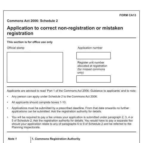
The Department for Environment, Food & Rural Affairs (DEFRA) has issued a notice concerning the correction of non-registration or mistaken registration of land under the Commons Registration Act 1965, as outlined in the application form CA13. This notice is vital for landowners, local authorities, and other stakeholders involved in land registration, especially those dealing with common land and greens in England.
Purpose of the Notice
This official document provides guidance on how to apply for corrections to the land register where certain land has either not been registered as common land or has been mistakenly registered. The process is governed by Schedule 2 of the Commons Act 2006, which allows eligible persons to request amendments to the register to reflect the true status of the land.
Scope of Application
The notice specifies that any individual or organisation can submit an application under Schedule 2 of the Commons Act 2006. This includes applications to:
- Register land as common land or as a town or village green.
- Deregister land wrongly registered as common land or as a town or village green.
- Correct registration errors involving buildings or other land wrongly classified.
Applications can also address specific issues such as the registration of waste land of a manor, which may have been incorrectly registered or needs correction based on legal determinations.
Application Process and Requirements
The notice emphasizes the importance of completing all relevant sections of the CA13 form, including details about the applicant, the land in question, and the reason for correction. Applicants are advised to:
- Read the accompanying guidance document titled “Part 1 of the Commons Act 2006: Guidance to applicants.”
- Ensure that the application is submitted before the prescribed deadline, as late submissions will not be accepted.
- Pay the applicable fee unless the application qualifies for an exemption under specific paragraphs of Schedule 2.
In addition, applicants need to provide an Ordnance Survey map of the land, clearly showing the relevant area hatched in blue, at a minimum scale of 1:2,500 (or 1:10,560 for moorland). Accurate identification of the land through grid references or other details is also necessary.
Supporting Documentation and Consent
Supporting documents are crucial for validating the application. These include:
- Declarations or written consents from landowners if part of the land includes buildings or is within the curtilage of a building.
- Any relevant legal or historical evidence that supports the correction request.
Applicants must list all supporting documents and maps submitted with the application. If the application involves land that is subject to legal disputes or objections, full details should be disclosed to facilitate the registration authority’s review.
Fill in your form directly online
No printing: type your details into the boxes of the official form, tick, then download the PDF ready to send.
- 1Type into the form boxes
- 2Tick in one click
- 3Save and download the PDF
Implications for Landowners and Stakeholders
This process ensures that the land register accurately reflects the legal status of land designated as common land or greens. Correct registration is essential for land management, planning, and community rights, including rights of common and village green protections.
By following the procedures outlined in the notice, applicants can rectify errors that may affect land use rights, ownership, or development plans. It is advisable for applicants to consult the guidance document and seek legal or professional advice if necessary, to ensure compliance with all legal requirements and deadlines.
Conclusion
The DEFRA notice on correcting land registration errors under the Commons Registration Act 1965 provides a clear framework for addressing inaccuracies in the land register. Proper application and supporting documentation are vital to ensure that the register accurately reflects the land’s status, thereby safeguarding community rights and land management interests.