When Countryside Management Meets Fire Prevention: The Critical Role of Wildfire Risk Assessment
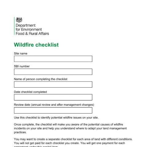
In the wake of increasingly severe wildfire seasons across Britain—from the devastating Yorkshire moors fires of 2018 to the Surrey heathland blazes of 2022—the Department for Environment, Food & Rural Affairs (DEFRA) has recognised that prevention begins with proper risk assessment. The Wildfire Checklist, administered through the Rural Payments Agency's countryside stewardship schemes, represents a fundamental shift from reactive fire-fighting to proactive land management planning.
This comprehensive assessment tool emerges from a growing understanding that wildfire risk isn't simply about weather conditions or accidental ignition sources. Modern fire prevention acknowledges the complex interplay between land management practices, site history, adjacent land uses, and public access patterns. For landowners participating in countryside stewardship agreements, completing this checklist isn't merely a bureaucratic requirement—it's a strategic exercise that can fundamentally reshape how they approach land management in an era of climate uncertainty.
The checklist operates as both a diagnostic tool and a planning framework, requiring participants to systematically evaluate their holdings through the lens of fire risk while simultaneously identifying potential mitigation strategies. Unlike generic fire safety assessments, this document specifically addresses the unique challenges facing rural land managers, from the fire risks associated with young conifer plantations to the ignition hazards created by mechanical harvesting operations during drought conditions.
Mapping Fire Risk: The Geographical Foundation of Wildfire Assessment
The cornerstone requirement of the wildfire checklist lies not in its tick-box questionnaire format, but in the annotated mapping exercise that must accompany every submission. This cartographic component transforms abstract risk factors into spatial realities, forcing land managers to visualise how different hazards interact across their holdings.
Participants must create detailed maps showing potential fire risks, access routes, and vulnerable areas, with each identified issue assigned a reference number for cross-referencing with the checklist responses. The mapping requirement acknowledges that wildfire behaviour is inherently geographical—fire spreads along corridors, is influenced by topography, and creates different risks depending on proximity to infrastructure or property.
For landowners managing multiple parcels with varying conditions, the guidance explicitly permits separate checklists for each distinct area. This flexibility recognises that a single holding might encompass mature broadleaf woodland, recently planted conifers, improved grassland, and unmanaged heathland—each presenting entirely different fire risk profiles requiring tailored assessment approaches.
| Map Feature Type | Essential Elements | Risk Assessment Purpose |
|---|---|---|
| Access Routes | Vehicle entry points, internal tracks | Emergency response planning |
| Fire-fighting Access | Water sources, helicopter landing zones | Suppression capability assessment |
| Previous Fire Areas | Historical burn scars, regeneration status | Recurrence probability analysis |
| Fuel Load Zones | Brash piles, dense vegetation areas | Ignition and spread potential |
The Rural Payments Agency acknowledges that accessibility considerations may prevent some participants from creating detailed maps. In such cases, comprehensive written descriptions can substitute for cartographic representations, though the agency reserves the right to recover funding if mapping capabilities exist but aren't utilised. This provision balances inclusivity with the fundamental requirement for spatial risk documentation.
Decoding Site History: Learning from Past Fire Incidents
The checklist's approach to historical fire analysis reflects sophisticated understanding of wildfire recurrence patterns. Rather than simply asking whether previous fires occurred, the assessment requires detailed documentation of each incident, including affected areas, dates, causes, and vegetation types involved. This granular approach recognises that fire history provides the strongest predictor of future fire risk.
The structured table format for recording historical incidents serves multiple analytical purposes. By documenting the specific causes of previous fires—whether from railway sparks, abandoned campfires, agricultural machinery, or deliberate ignition—land managers can identify recurring risk patterns and develop targeted prevention strategies. The vegetation type classification helps predict how future fires might behave in similar conditions, while the affected area documentation provides scale references for emergency planning.
Particularly significant is the recognition that managed burning operations, while conducted intentionally, represent ongoing fire risks requiring specific assessment. The checklist acknowledges that even controlled burns can escape containment, particularly during drought conditions or when undertaken in proximity to vulnerable vegetation or infrastructure. This nuanced approach avoids the false dichotomy between "good" and "bad" fire use, instead focusing on comprehensive risk evaluation.
For sites with extensive fire histories, the reference numbering system allows cross-correlation between historical incidents and current land management practices. A hillside that burned repeatedly due to railway ignitions might warrant different vegetation management compared to areas where fires resulted from recreational activities or agricultural operations.
Contemporary Fire Risk Factors in Land Management
The site management section addresses how current land use practices influence fire susceptibility, moving beyond simple fuel load assessments to consider management-induced vulnerabilities. The emphasis on vegetation structure diversity reflects emerging understanding that varied habitats often demonstrate greater fire resilience than monoculture systems.
Drainage status receives particular attention, recognising that artificially drained sites create fundamentally different fire environments compared to naturally wet areas. The assessment doesn't automatically classify drainage as negative—many conservation objectives require active water management—but ensures that fire risk implications are explicitly considered in management planning.
The treatment of recently planted woodland demonstrates sophisticated risk stratification, particularly the identification of thicket-stage conifers as presenting particularly high fire risks. This specificity helps land managers understand that fire vulnerability changes dramatically as plantations mature, requiring adaptive management strategies as forests develop.
External Ignition Sources: Assessing Risks Beyond Site Boundaries
One of the checklist's most valuable contributions lies in its systematic assessment of external ignition sources, acknowledging that wildfire risk often originates beyond property boundaries. The framework addresses three primary external risk categories: transportation infrastructure, commercial activities, and residential behaviours.
The specific identification of steam railways alongside conventional roads reflects detailed understanding of ignition mechanisms. While modern diesel and electric trains present minimal fire risks, heritage steam operations and some industrial railways continue using coal or wood-fired locomotives, creating spark risks during dry conditions. This granular approach demonstrates the checklist's basis in practical fire investigation experience rather than generic risk assessment theory.
Commercial and industrial risk assessment extends beyond obvious hazards like fuel storage or metalworking operations to encompass any business activities that might generate ignition sources. This broad interpretation might include agricultural contractors using spark-generating machinery, construction operations involving welding or cutting, or even commercial composting facilities that can generate spontaneous combustion risks.
The domestic property assessment recognises that residential fire risks often stem from well-intentioned activities like garden waste burning or barbecue use. The checklist's non-judgmental approach acknowledges these as legitimate activities requiring risk management rather than elimination, encouraging dialogue between land managers and neighbouring residents about appropriate timing and precautions.
Public Access Patterns and Fire Risk
The assessment of public access represents one of the most complex aspects of wildfire risk evaluation. The distinction between managed and unmanaged public access reflects understanding that supervision and infrastructure significantly influence fire risk levels. Rights of way with regular maintenance, clear signage, and active management typically present lower risks than informal access areas lacking oversight.
The specific mention of CROW Open Access land acknowledges the particular challenges created by the Countryside and Rights of Way Act 2000, which granted extensive public access rights across mountain, moor, heath, and down landscapes—precisely the environments most susceptible to wildfire. These legal access rights cannot be restricted for fire prevention purposes, making risk assessment and mitigation planning particularly crucial.
High-use recreational areas face compound risks from multiple ignition sources: discarded cigarettes, disposable barbecues, camping equipment, and vehicle exhausts. The checklist's focus on antisocial behaviour including deliberate fire setting acknowledges the unfortunate reality that some wildfire incidents result from intentional ignition, requiring different prevention strategies than accidental fires.
Operational Hazards: When Land Management Creates Fire Risks
The checklist's treatment of operational fire risks demonstrates sophisticated understanding of how routine land management activities can create ignition hazards under specific conditions. The assessment of mechanical cutting operations during drought periods addresses a significant but often overlooked risk factor in modern agriculture and forestry.
The specific example of harvester blades striking flints during harvest operations illustrates the kind of detailed risk analysis underlying the checklist development. This scenario—common in areas with glacial geology or chalk downland—can generate sparks capable of igniting dry crop residues or adjacent vegetation. Similarly, the identification of rocky ground mowing risks acknowledges that seemingly routine maintenance operations can become fire hazards under drought conditions.
Brash pile management receives explicit attention, recognising that post-harvesting debris creates concentrated fuel loads that can sustain intense fires and facilitate fire spread across landscapes. The temporal aspect is crucial—brash piles may present minimal risks when created during wet conditions but become significant hazards as they dry out over subsequent months or years.
The assessment framework doesn't prohibit these necessary management activities but ensures that their fire risk implications are explicitly considered in timing and methodology decisions. This approach supports continued productive land use while encouraging risk-aware operational planning.
Consequence Assessment: Understanding Wildfire Impacts Across Multiple Domains
The checklist's systematic evaluation of potential wildfire consequences represents a comprehensive approach to impact assessment that extends far beyond immediate property damage. The framework recognises that wildfire effects cascade across multiple domains—human safety, livestock welfare, agricultural productivity, infrastructure functionality, and economic activity.
The prioritisation of human life and health impacts reflects legal and ethical obligations while acknowledging that rural wildfires often threaten both residents and emergency responders. This assessment component encourages land managers to consider evacuation routes, communication systems, and coordination with emergency services in their fire planning processes.
Livestock considerations address both direct fire impacts and secondary effects like smoke inhalation, stress, and loss of grazing resources. The assessment acknowledges that animal welfare during wildfire events requires advance planning, particularly for extensive grazing systems where rapid livestock movement may be difficult or impossible.
The treatment of critical infrastructure demonstrates understanding of wildfire's potential for cascading failures across interconnected systems. Gas pipelines, telecommunications infrastructure, and electrical distribution systems can suffer both direct fire damage and secondary impacts from smoke, heat, and emergency response activities. The specific mention of wind turbines acknowledges their increasing prevalence in rural landscapes and their particular vulnerability to fire damage.
Economic and Social Impact Evaluation
The comprehensive approach to economic impact assessment extends beyond direct property damage to encompass business disruption, tourism effects, and long-term productivity losses. This broad perspective recognises that wildfire consequences often persist long after flames are extinguished, affecting regional economies through reduced agricultural output, tourism disruption, and infrastructure repair costs.
The inclusion of sporting, retail, and leisure businesses in impact assessment reflects the diversified nature of modern rural economies. Shooting estates, farm shops, glamping operations, and outdoor activity providers all face distinct wildfire vulnerabilities requiring specific assessment approaches.
| Impact Category | Assessment Focus | Planning Implications |
|---|---|---|
| Human Safety | Evacuation routes, communication systems | Emergency coordination protocols |
| Agricultural Assets | Crop damage, grazing loss, fencing destruction | Recovery planning, insurance evaluation |
| Infrastructure | Utilities, transport links, telecommunications | Service continuity, repair coordination |
| Business Operations | Tourism disruption, commercial premises | Continuity planning, alternative provisions |
Strategic Implementation: Integrating Wildfire Assessment into Stewardship Planning
The wildfire checklist operates within the broader framework of countryside stewardship agreements, representing one component of comprehensive land management planning rather than a standalone fire prevention exercise. This integration ensures that fire risk considerations become embedded in long-term management strategies rather than treated as isolated assessments.
The capital item payment structure reflects this strategic approach—participants receive one payment per agreement regardless of the number of checklists created, encouraging thorough assessment across entire holdings rather than selective evaluation of high-risk areas. This payment methodology recognises that comprehensive wildfire planning often requires multiple assessments to address varied conditions across complex land holdings.
The annual review requirement, supplemented by additional reviews following management changes, ensures that fire risk assessment remains dynamic and responsive to evolving conditions. Land use modifications, vegetation succession, infrastructure development, and climate variations all influence fire risk profiles, necessitating regular reassessment to maintain planning relevance.
The encouragement to consult local Fire and Rescue Services and wildfire groups reflects recognition that effective fire prevention requires coordination between land managers and emergency response organisations. Community Risk Management Plans and local resilience forum registers provide valuable context for site-specific assessments, identifying regional fire patterns and response capabilities that influence individual property planning.
This collaborative approach acknowledges that wildfire prevention and response operate across administrative and ownership boundaries, requiring coordination between private land managers, public agencies, and emergency services to achieve effective landscape-scale fire management. The checklist serves as a communication tool facilitating this broader coordination while ensuring that individual land managers understand their roles within regional fire prevention strategies.